|
|
|
|
Some Smiths |
|
|
|
Parksville City Loop(AKA: Tour de Parksville) Parksville, BCDirections:Drive to Rathtrevor Beach Provincial Park in Parksville (49.32098, -124.26592). Park anywhere and cycle to the beach campground gate. Continue through the park until you reach the West exit to Saint Pareil. Follow the route. It's also possible to cycle along the ocean edge path to the same point, although on warm sunny days, there are lots of walkers on that path. Conditions:This route is mostly city streets, although there are bike paths in Rathtrevor campground, the Wetlands, and a short boardwalk along the Parksville Beach. The Trip:Lots to see along the way: forest through the park and the wetlands, boardwalk along the beach, and a wide variety of Parksville homes and buildings.
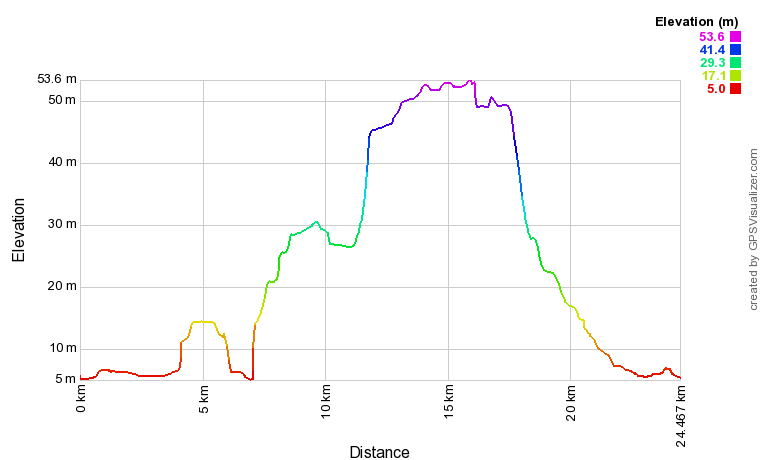
If you go in the morning, after the trip you can set up a picnic at one of the tables in the park or eat at one of the Food Trucks that are usually there. Map:The map below is a Google "My Maps" embedded document and you can double click on it and expand it to see it better on either your computer or smart phone. If you'd like to download the actual GPS data to use instead, click on this link: Tour de Parksville or click here for a Google Maps guide. The route has a few ups and downs, but all the hills are mild and overall it's quite flat. The graph below looks extreme, but the elevation gain/loss is only 55 meters. |
|
